Intro
Design
Airframe
Hardware
Software
Testing
Launch 5
Glossary
Links
Contact
Third Launch
| November 18, 2001 |
Mr. Toad's Wild Ride For this launch, the altitude goal was nominally 45,000 feet (14 km), but perhaps to as high as 50,000 feet (15.5 km) if that turned out to be necessary. The jetstream winds usually run in a band between 25,000 and 35,000 feet, so if it gets blown too far downwind, going to a higher altitude can help provide enough glide-back range. Weather predictions prior to launch were for the high altitude winds to be from the S-SE at moderately high speed. There are no photos this time of the launch itself, but except for the cold, huddled look of the ground crew, it was all pretty much the same. |
 |
|
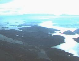
If you're familiar with the region, you might notice that the flight path went over the Victoria airport property. However, there was never any risk of landing (or, for that matter, crashing) near the airport, because by that point it was at over 14,000 feet ASL, in 50 kts winds - over 10,000 feet above the local pattern. Thus if it release and went out of control in any way, it would have landed far down wind (NW). With more altitude, the wind veered to be almost directly from the South. It was decided to release the glider from the balloon at about 35,000 feet, before it got over the Straight of Georgia (the large area of open water near the top of the map). The idea was to leave some chance to land on the island if it didn't gain control. But this was probably the wrong decision, as the wind would take it over the Straight in any event if it didn't fly properly. Immediately after release, the glider recovered into level flight, but it didn't straighten out completely. We thought this was due to the strong headwinds confusing the ground track, and waited for the autopilot to nose down to pick up speed into the wind. But, this was the wrong idea, as it turned out it hadn't trimmed out properly in roll. So the glider simply pitched down into an ever-faster spiral dive, with steadily building G's. After realizing this might be a roll-trim problem, the glider was commanded to try trimming itself out again, which it did, properly this time. It began to fly a course home at that point, but then, apparently yearning for more excitement, the autopilot decided to pitch down one more notch. One too many - a screaming dive resulted. We didn't notice that some of the G readings were actually negative (next time, that little minus sign will be bright orange). Finally cluing in, we sent a command to disengage the auto-pitch trim, and the elevator was manually trimmed up some. This resulted in strong positive G's, and after some porpoising, it was in straight and level flight, headed back home. But with all the glider's initial misadventures, it no longer had enough altitude to make it all the way back to the launch site. At first we told it to try for a spot on North Galliano. But after checking the ferry schedule, we changed our minds, and told it go for a safe site on Saltspring Island. As it gained a comfortable distance over the gulf islands, as opposed to the open water, we began to gain confidence again. Because the mountains on the south end of Saltspring would cause a loss of signal as it descended lower, it was (unwisely) decided to adjust the pitch trim one last time. Little did we know what happened next - it was not obvious until the telemetry data was inspected later on. We lost the contact with the glider at about 7000 feet over the north end of Saltspring. After hopping a ferry over, and a couple of hours of searching, we received a position packet, and recovered the glider intact. |
|
|
  |
  |
|
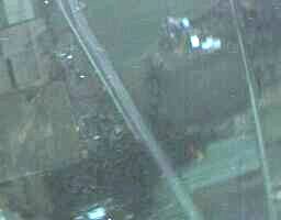
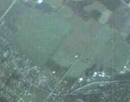
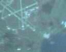
Quickcam shots received during the flight, of varying resolution and
exposure quality. The new iris worked very well - the quickcam shots now
have some colour. It still has problems with extreme contrast
situations (as in the photo on the lower right, taken of Saltspring during the
return flight), but that's probably a limitation of the webcam itself. |
|
|
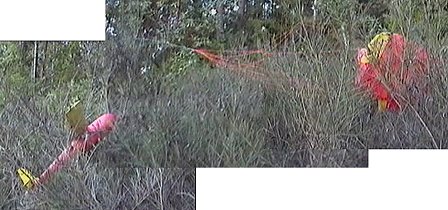 |
| The glider was found in good condition a few hundred yards from a road. Damage was limited to a scratch on the nose cone. The chute appeared to have deployed perfectly. |
Well, any flight where the glider is recovered intact is a success. But as far as meeting the goals for this test, this flight was a mixed bag. The changes to the external temperature sensor, quickcam, and chute packing worked well. The auto pitch/airspeed caused some problems, however, and there were issues with trimming for straight flight in strong high altitude winds. On the bright side, it did achieve controlled flight for a second time, and the glider was tested throughout its flight envelope in ways that we would never have had the nerve to attempt on purpose. The data from that turns out to in fact be very valuable. But what really happened up there? We really had no idea ourselves until that same evening, when we took a close look at the telemetry data. Click to Digesting 3 to find out.
|