Intro
Design
Airframe
Hardware
Software
Testing
Launch 5
Glossary
Links
Contact
First Launch
|
June 17, 2001 |
| Bail-Outs, Boats, and Border
Guards
After months of delay as everything was tested to exhaustion, various ground crew people's weekend schedules were worked around, and then finally, waiting for weather - the day arrived. The first attempt at a flight launched by balloon, and the first flight in which the "guts rack", loaded with navigation, sense, and computer / telemetry hardware, would be installed and allowed to attempt to fly the glider. The target altitude was 13.5km, or about 43,000 feet. This was chosen perhaps as much on the basis of bravado as reason. Simulator practice trials showed that up to say 15,000 feet, going higher is actually safer than lower. This is because there should be little difference in the flying qualities (true airspeed, etc) of the glider up to that high, yet you have enough time to make decisions and correct control problems. Higher than 15k or so, and the risk slowly increases, due to higher true airspeeds. But a launch of any kind seemed so inherently risky, that it seemed to make sense to just go for a moderately high altitude right off. At least then, the hardware would be tested in high-altitude conditions, and the airspeed would still be less than 100 knots for the cruise portion of the glide back. So went the theory....
|
|
The instrument displays are easy enough to see, but the quickcam photo window loses contrast. |
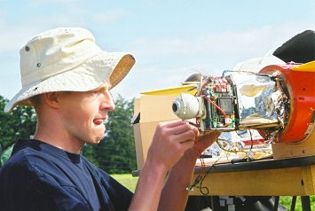
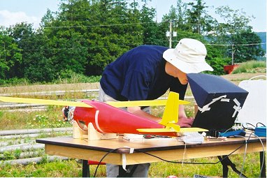
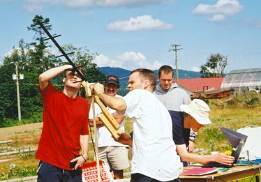
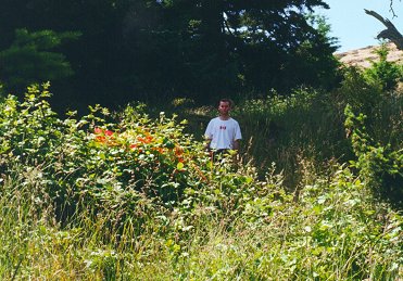
The guts-rack is installed at the field, to allow every system to be visually inspected just before flight. The developer here (myself) had begun to have a fatalistic feeling it was all a sort of crude, ritualized sacrifice of expensive equipment to the sky. |
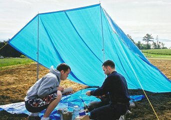
"Base Camp" In the words of a member of the balloon crew, "that thing is |
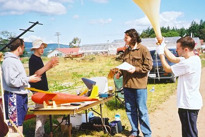
Almost ready to release, we go over the launch steps. (L to R, Steph, myself, Owen, and Mike) |
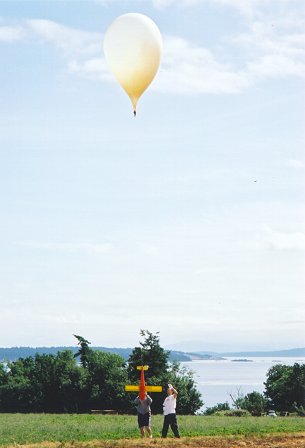
| That's Haro Straight behind the balloon crew, |
  |
|
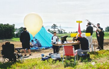
A perfect launch. Light winds, sunny day, |
 The laptop's battery died part way through the flight. Probably caused by the inverter becoming slightly unplugged from the ground-power 12v battery, although at the time we thought the ground battery must have run out. So, the glider was totally unsupervised for about 5 minutes, as we drove a car up to give the ground station a boost. |
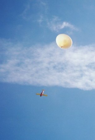
This made it easy to find the balloon in the sky as well - you could just sight along the antenna. Amazingly, you could see the balloon with the naked eye all the way up to 43,000 feet or so. We didn't expect that.
|
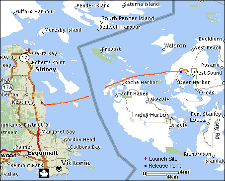 |
The launch point is at the left end of the track-trail. The jetstream forecast was for the high level winds to be from the SW, taking it over South Pender Island and thereabouts. But by around 30,000 feet or so, it was clearly just going East, and we began to think about releasing before we crossed the Canada / US border. The glider and balloon are legal under FAA rules, but it seemed best to avoid US airspace even so. Then the laptop shut down due to dead batteries. You can see the gap in the data. By the time it was running again, we were across the line, and so decided we might as well just go for the target altitude. If we had to hit the chute, it would end up across the line in any event. It went up to over 43,000 feet, cut itself free, but failed to recover into a proper glide. At an IAS speed that approximated the "maximum dive speed" - at which, at normal trim, the wings would be at their max design load (7g's) - the airspeed indicator and GPS lock died at the same instant. The lost airspeed meant the right wing, which has the pitot tube, had parted company, and the intermittent GPS signal implied a violent tumble. The descent speed also slowed a great deal - but still, the moving-map display showed it going straight down, over the end of Orcas Island's West Sound. The peanut gallery was as silent as a funeral. It would hit the parachute on its own at 450m (1500 feet or so), but planning the landing site seemed a better idea, to avoid a splashdown, or parachuting onto a road. The ground software has a feature where it records the winds on the way up, and can be asked to constantly display a small circle indicating where it would land if the chute were hit at that moment, based on the altitude and last position. As the indicator moved across the island, we picked a spot that was well away from the shore or any towns on the map, and the glider was told to hit the chute (at about 3000 feet). We held our breath, but the chute worked instantly, the speed dropped to a gentle descent, the GPS become reliable again, and it landed right on the predicted spot, a ridge on Orcas Island away from any roads, etc. It sent back one last (crappy) quickcam photo of a nearby valley, and then lost contact as it went behind trees. Two rushed hour later, after a long pounding trip in a very small boat, three of us were negotiating with a somewhat flat and humourless US customs officer at the nearest customs dock. This took some time due to (a) our decision to tell the truth about why we were visiting the states, which caused eyebrows to go up and our boat to be thoroughly searched, and (b) one person who shall remain unnamed forgetting to bring a second piece of personal ID, which caused lengthy questioning. It seemed that they weren't in the slightest worried about whether what we claimed to be doing was legal, so much as that it all came across as so weird, they thought we must have made it up as a cover for something else. We offered to leave the guy without enough ID behind with them as a guarantee, but by that time they were satisfied. In the entrance to West Sound, we booted up the laptop and data radio to listen for the 4pm "ELT" position signal - which came at 16:00:01, dead on. The position was just 10m or so off our last telemetry packet, but 30m lower, which made sense. After a few km's hike up, and a bush-whacking climb up the ridge to 600' ASL, a handheld GPS led us to the glider. It was in good condition, all things considered - right wing missing, left wing there but shattered, and the fin bent sideways, but no damage to the fuselage or hardware. The border crossing back into Canada consisted of a big red sign at the end of a deserted marina slip, with a 1-800 number. We called the number from a cell and they "let us back in" over the phone. Oh, Canada.
|
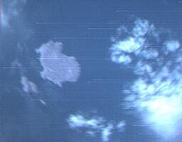
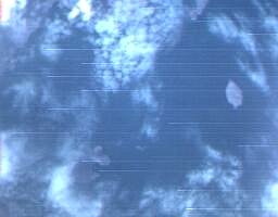
| Some quickcam shots received during the flight. They vary quite a bit in resolution, and the quickcam has a hard time with bright outdoor conditions. Also, one of its "sunglass" shades for that doesn't seem to be neutral in colour, so green is missing from these images. But, the landforms in the 2nd, 3rd, and 4th are recognizable if you're familiar with local marine charts. |
  |
  |
  |
|
|
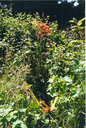
This is the view after a 30 minutes of bushwacking up the mountainside. At first, from the edge of the clearing, we thought it might just be a bit of red vegetation. At least it wasn't in a tree! |
The glider itself was buried in the brambles. It hit at low speed - as far as we could tell from the way it sat, any airframe damage happened while it was airborne. One parachute shroud line was broken at the chute-end knot, however. It's hard to tell whether that happened going by a tree on the way down, or when the parachute opened. |
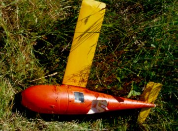
Note that the chute hatch is missing. As the glider was tumbling when it opened, the main line may have hooked itself around the hatch's fabric strap hinge. |
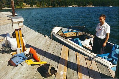
So the trip back was probably as hard on the glider as the flight itself, even though it was wrapped in floater coats and the boat cover. But it was all fun. (Mike's smiling here, you just can't see it. Julian's checking for the nearest open fuel dock with a cell.) |
|
Well, we flew it. Or, perhaps dropped it would be a better description. We got the second best outcome, no proper flight as an aircraft, but all the systems worked, we obtained good data, and most of all, recovered to try again another day. Strangely, the result was satisfying enough, and the day itself was a blast, overall. By the time of this launch, it was obvious that the best direction for a design that would be able to reliably meet the original (very high) altitude goal would be to aileron/roll control using a rate-command and roll-gyro system. With the exception of the chute bay hatch, the parts lost or broken were those that would have had to be rebuilt to use that method, anyways. The project had also come to seem so large and complex prior to the launch, that I had begun to have a fatalistic attitude towards it - but all the systems, software, and contingency plans actually worked! So, at this point the systems / software, and the airframe, are both proven to function well in the field - each on their own. Now one just has to be convinced to get the knack of steering the other.
|