Intro
Design
Airframe
Hardware
Software
Testing
Launch 5
Glossary
Links
Contact
Fifth Launch
| September 6, 2003 |
|
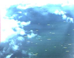
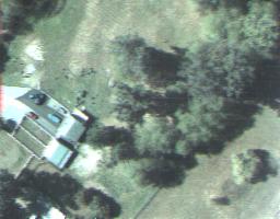
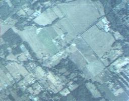
Lost Glider For this launch, the altitude goal was as high as an 800g balloon could carry it. The flight had three goals (besides the fun of a launch) : to fly higher, to test the idea of using a small drogue chute to aid dive recovery, and to finally get some decent very high-altitude photos. The launch site was a small acreage, a bit south of Langley, in the Fraser Valley, whose use was generously provided to us by the family of Ryan Thom, one of the launch crew. We had waited several weeks for southerly upper air winds, to ensure it wouldn't drift south of the border. After ascending to 74,000 feet, the balloon burst, and the glider began to fall. This time, a small cotton drogue chute of about 0.1m2 was attached to the tail release point, in the hopes of stabilizing and limiting the dive, giving a less stressful recovery. The camera bay had also been improved - vented to ensure it stayed dry. Software changes included the drogue chute timing routine, plus a few minor tweaks to the nav routines. A few quickcam shots from the ascent follow: |
  |
|
After the balloon burst, the glider did not, however, fly straight. It didn't just spiral, as when the gyro has had drift problems. It wobbled, very badly, apparently due to the drogue chute. I've experimented with drogue chutes in the past, at sea level, and they normally trail in a stable enough way - so this may be due to the combination of small size, high speed, and low air density. Or, maybe just some asymmetry in the drogue. In any event, as a result, when the drogue chute was cut away, the trim routines had not sorted out what a zero roll rate should be like, and instead had trimmed for a rapid spiral. During the ascent, the glider had drifted some 65nm away, over the BC coastal mountains, so the telemetry link was usable, but poor. As a result of this (and a poor decision to launch despite the main "pilot" not having got a lot of sleep the night before), we didn't sort out what was wrong until it had dropped to below 30,000 feet, several minutes later. By then it had partially trimmed itself level, but not yet enough. At that time, the trim routine was run again, and the glider immediately levelled out and started to head back home. Unfortunately by then, it was about 65nm north, flying in strong headwinds at 23,000 feet over the coast mountains (up to 9000 feet), with a poor line of sight for the radio link. The radio link was bad enough, that we scrambled (mash style) to move all the gear down the road aways, hoping for a better line of sight. After several minutes, we re-established a good link, partly because it had flown to a position that (by a minor miracle) had a good line of site down a network of valleys. Some fairly worrying quickcam shots were sent back, that didn't reduce our concern much. With the help of a commercial pilot friend along for the launch, we began to locate it on the aviation charts to find a safe landing site, and a way to avoid the rocks. Unfortunately, there wasn't a lot of time left; an alternate landing site was chosen near a logging camp, but to get there, it had to clear one final 7900 foot mountain, with only 11,000 feet of altitude left. If it did, it would either reach the landing site, and land by parachute precisely where we told it, or failing that, hit the chute at 3000 asl. Here's the last (ominous) quickcam photo received, just before final loss of contact, several nm short of the mountain in question: |
|
|
| Headwinds were strong - up to 50 kts. Projecting from where radio
contact was lost, it either just barely missed, or hit just below, the
mountain peak. Unfortunately because the "short of
landing site" emergency chute altitude was set to 3000 feet, with
the idea of having the most controlled landing possible in the Fraser
Valley, and the glider's software was innocent of any knowledge of
mountains, it was a hit or miss thing. The valley was safe; the mountain
was a "controlled flight into terrain" scenario.
As the site is some 50nm north of Chilliwack, 4 hours drive from the nearest paved road, we elected to fly over it the next weekend in a small C172 to try and pick up an exact "ELT" fix. But no signal was received. The electronics and telemetry software have proven to be extremely reliable, so the lack of signal can only be taken as evidence that the glider flew into the top of the mountain below at cruise speed: |
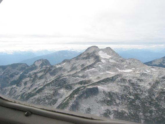 |
|
This is a relatively benign mountain peak compared to its neighbours, in one of the most rugged, glaciated regions in the world. The ocean is started to seem a better option! These mountains kill people every year far more equipped than I or my friends are for backcountry exploring. In fact despite having flown a couple of hundred hours in small planes without ever being nervous about engine failure, here you can hear every burble of the little Lycoming quite keenly. So there it will rest, perhaps for some future archaeologist to find. So, that seems to be it for the Mark I. This was supposed to be the final flight before being retired, to collect a bit more data and some nice photos. Then, time permitting, the plan was to build a Mark II, designed to be far lighter, better performing (especially re trim), lower cost, and easier to use. The first glider was overly modular, and heavily modified, requiring almost a complete rebuild before each flight - very much experimental, and a fun recreational project. In addition, the glider project prompted me to go back and finish a physics degree, which has ironically much delayed work on the glider (and this webpage). This has been a lot of fun so far though - and I feel very lucky to have gotten this far in such a risky project before losing a prototype. I may yet build another version, to put into practice all I've learned about small scale, extreme altitude gliding flight. |