Intro
Design
Airframe
Hardware
Software
Testing
Launch 5
Glossary
Links
Contact
Fourth Launch
| August 24, 2002 |
|
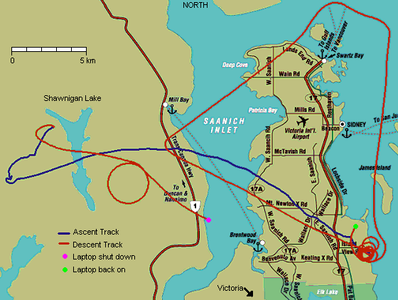
Successful High Altitude Flight For this launch, the altitude goal was 18.5km, or just over 60,000 feet. This altitude was achieved relatively close to the launch site, and an hour or so after launch the glider released itself from the balloon. It dropped into controlled and well-trimmed flight immediately after release this time, correcting the expected few degrees of gyro drift from the ascent with no problems whatsoever (field photos). Maximum G level during the pullout only reached 2.5g's, and maximum true airspeed about 380 kph (205 kts). After pulling out into level flight at about 57,000 feet, the glider was commanded to do a panoramic photo turn (the circle on the chart below), and then return home. Cruise airspeed was 230 kph (125 kts) or more. It arrived back over the launch field with something like 45,000 feet to spare, at which point we changed the glider from smart-pilot to ground-commanded autopilot mode, and told it to take a few side trips around the area to snap 35mm photos.
|
 |
|
But the 35mm photos later turned out to be a great disappointment, as none of the high altitude aerial shots turned out. Some modifications made to the camera bay, sealing it up and using silicon desiccant to reduce condensation, seemed to have badly backfired. The condensation was so bad, most photos are badly blurred. Next time, the opposite tack will be taken - gentle venting of the camera bay with cold, dry outside air. Of course this would all be simpler if "amphibious" landing-out hadn't been part of the design spec, requiring it to be almost watertight. The remainder of the flight from 30,000 feet down was spent in smart-pilot mode, with the glider self-flying a tight approach pattern over the launch field. All systems worked perfectly, with the exception of the pressure altimeter, which started to go a bit wonky above 55,000 feet. Fail-safe routines finally tripped it out of service as the pressure dropped below 9% of sea level, but the autopilot was able to use GPS-based altitude to fill in the gap and estimate TAS, etc. The pressure sensor came back into service as the glider flew below 55,000 feet again, however. This later turned out to be caused by temperature drift of the baro sensor, which has since been adjusted for. The very low ambient pressure at high altitude tends to strongly amplify the effects of any baro sensor drift on the baro altimeter. Winds were light from the west in the last few thousand feet, but there was a moderate easterly breeze off the water within only a couple of hundred feet of the ground, causing some inaccuracy in the landing. Because the glider planning its final approach based on the winds in its last circuit, several hundred feet up, it popped the chute a little off from where it should have, and landed a few hundred metres away from the set landing site. Not bad though, and it passed within 11m of directly overhead as it flew upwind (or what it thought was upwind) to pop the chute. Although there were few decent 35mm photos this time, the quickcam did work relatively well. Here are a few of the better shots which were transmitted down during the flight:
|
Several thousand feet above the launch field, during a spiraling ascent in light winds.
|
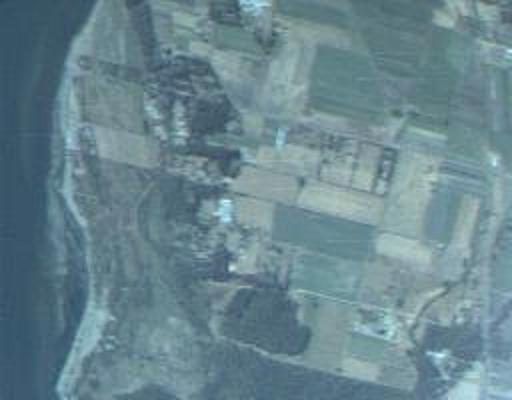
 A chunk of Saanich Inlet, at around 40,000 feet.
|
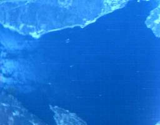
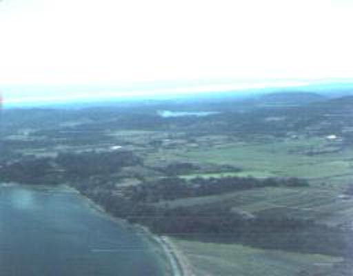
About 50,.000 feet over Shawnigan lake, a bit hazy due to intervening moisture?
|

A bit of a blurred shot towards Vancouver from around 50,000 feet during the return flight. You can see the Tsawwassen ferry terminal on the lower edge, just right of centre. Note the dark sky!
|
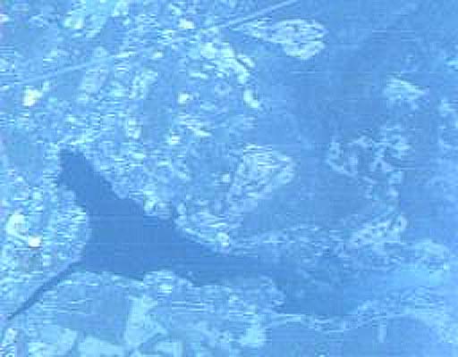
On final approach to the landing site, dead centre here. It "threaded the needle" perfectly, passing within only a few metres of directly overhead. Too bad its estimate of the wind direction was a bit off due to the terrain twisting surface winds around. We expected this problem after watching the ascent path of a small party balloon late in the flight, but couldn't think of a fix that would still maintain the legitimacy of the fully-automatic landing test.
|